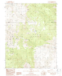
1987 Map of Crooked Creek
USGS Topo · Published 1987About this map
Ancient Bristlecone Pine Forest and the high-elevation terrain of Inyo National Forest dominate this mid-1980s provisional study of the White Mountains. The landscape is defined by its verticality and deep drainages, notably Royal Gorge and the winding course of Crooked Creek. Evidence of historic resource extraction is scattered throughout the slopes, including the Wilkerson Mine and numerous unnamed prospects that follow the geology of Roberts Ridge. Sparse human habitation is centered at the Roberts Ranch, while the surrounding peaks like Iron Mountain and Sentinal Peak remain accessible primarily via a network of 4wd tracks. This map documents a remote transition zone where biological conservation meets the legacy of mountain prospecting.
Find a feature on this map
25 named features on this map. Tap any name to fly to it.
Don’t see what you’re looking for? This feature index may not catch every label — zoom into the map to look around manually.
Map Details
Editions of this 1987 Crooked Creek Map
2 editions found
Other maps of this area

1898 · Silver Peak
USGS Topo · 1:125,000

1900 · Silver Peak
USGS Topo · 1:125,000

1908 · Lida
USGS Topo · 1:250,000

1913 · Bishop
USGS Topo · 1:125,000

1913 · Lida
USGS Topo · 1:250,000

1917 · White Mountain
USGS Topo · 1:125,000

1947 · Mariposa
USGS Topo · 1:250,000

1948 · Mariposa
USGS Topo · 1:250,000

1951 · Blanco Mountain
USGS Topo · 1:62,500

1954 · Goldfield
USGS Topo · 1:250,000