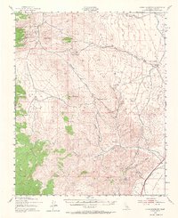
1943 Map of Cross Mountain
USGS Topo · Published 1967About this map
The Mojave Desert terrain of eastern Kern County is defined here by high-elevation peaks and a network of mining claims active during the early 1940s. Water management and transportation infrastructure dominate the southern landscape, where the Los Angeles Aqueduct snakes through the foothills near Jawbone Canyon. Along the southeastern edge, the Southern Pacific railroad line connects the small siding at Cinco to the broader regional network.
Find a feature on this map
43 named features on this map. Tap any name to fly to it.
Don’t see what you’re looking for? This feature index may not catch every label — zoom into the map to look around manually.
Map Details
Editions of this 1943 Cross Mountain Map
5 editions found
Other maps of this area

1906 · Kernville
USGS Topo · 1:125,000

1908 · Kernville
USGS Topo · 1:125,000

1915 · Searles Lake
USGS Topo · 1:250,000

1915 · Mojave
USGS Topo · 1:125,000

1943 · Tehachapi
USGS Topo · 1:62,500

1943 · Inyokern
USGS Topo · 1:62,500

1943 · Cross Mountain
USGS Topo · 1:62,500

1943 · Emerald Mtn
USGS Topo · 1:62,500

1943 · Saltdale
USGS Topo · 1:62,500

1943 · Onyx
USGS Topo · 1:62,500