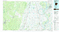
1986 Map of Crossett
USGS Topo · Published 1986About this map
Crossett and its industrial layout serve as the anchor for this mid-1980s landscape, where the timber and rail legacies of Ashley County meet the floodplain geography of the Mississippi Delta. The Missouri Pacific railroad connects numerous small settlements such as Montrose, Portland, and Parkdale, tracing a corridor through the flat agricultural lands between Bartholomew Bayou and the winding course of the Mississippi River.
Find a feature on this map
159 named features on this map. Tap any name to fly to it.
Don’t see what you’re looking for? This feature index may not catch every label — zoom into the map to look around manually.
Map Details
Editions of this 1986 Crossett Map
2 editions found
Other maps of this area

1909 · Wilsons Point
USGS Topo · 1:24,000

1909 · Millikin
USGS Topo · 1:24,000

1909 · Ashton Bridge
USGS Topo · 1:24,000

1912 · Ashton Bridge
USGS Topo · 1:31,680

1913 · Wilson Point
USGS Topo · 1:31,680

1933 · Lamont
USGS Topo · 1:62,500

1934 · Ingalls
USGS Topo · 1:48,000

1934 · Felsenthal
USGS Topo · 1:62,500

1935 · Mist
USGS Topo · 1:62,500

1935 · Wilmot
USGS Topo · 1:62,500