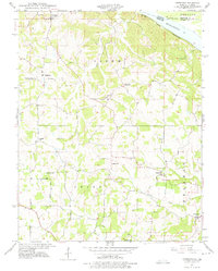
1947 Map of Crosstown
USGS Topo · Published 1975About this map
The Mississippi River creates a natural boundary along the northeastern edge of this Perry County landscape, where the St Louis San Francisco railroad follows the riverbank. Inland from the water, the terrain is characterized by a dense network of rural schoolhouses and small agricultural settlements. Small communities such as Crosstown, Farrar, Brazeau, and Frohna serve as anchors for the surrounding townships of Salem, Union, and Brazeau.
Find a feature on this map
24 named features on this map. Tap any name to fly to it.
Don’t see what you’re looking for? This feature index may not catch every label — zoom into the map to look around manually.
Map Details
Editions of this 1947 Crosstown Map
3 editions found
Other maps of this area

1915 · Chester
USGS Topo · 1:62,500

1916 · Campbell Hill
USGS Topo · 1:62,500

1918 · Altenburg
USGS Topo · 1:62,500

1918 · Campbell Hill
USGS Topo · 1:62,500

1923 · Perryville
USGS Topo · 1:62,500

1924 · Perryville
USGS Topo · 1:62,500

1925 · Altenburg
USGS Topo · 1:62,500

1947 · Chester
USGS Topo · 1:62,500

1947 · Crosstown
USGS Topo · 1:24,000

1947 · Oak Ridge
USGS Topo · 1:24,000