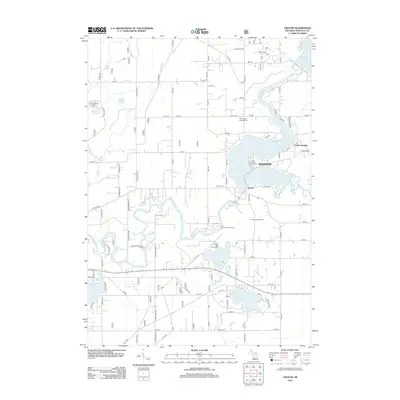
2012 Map of Croton
USGS Topo · Published 2012About this map
Croton sits at the heart of this riverine landscape, where the confluence of the Muskegon River and its various tributaries are harnessed by substantial impoundments. The village is flanked by the expansive waters of the Croton Dam Pond and Hardy Dam Pond, which dominate the eastern topography. These reservoirs have shaped the local identity, fostering recreational hubs like the Croton Township Campground and the residential area of Croton Heights.
Find a feature on this map
81 named features on this map. Tap any name to fly to it.
Don’t see what you’re looking for? This feature index may not catch every label — zoom into the map to look around manually.
Map Details
Editions of this 2012 Croton Map
This is the sole edition of this map. No revisions or reprints were ever made.
Other maps of this area

1954 · Midland
USGS Topo · 1:250,000

1958 · Midland
USGS Topo · 1:250,000

1958 · Sand Lake
USGS Topo · 1:62,500

1958 · Fremont
USGS Topo · 1:62,500

1958 · Woodville
USGS Topo · 1:62,500

1959 · Midland
USGS Topo · 1:250,000

1959 · White Cloud
USGS Topo · 1:62,500

1966 · Midland
USGS Topo · 1:250,000

1976 · White Cloud SE
USGS Topo · 1:24,000
1984 · Big Rapids
USGS Topo · 1:100,000