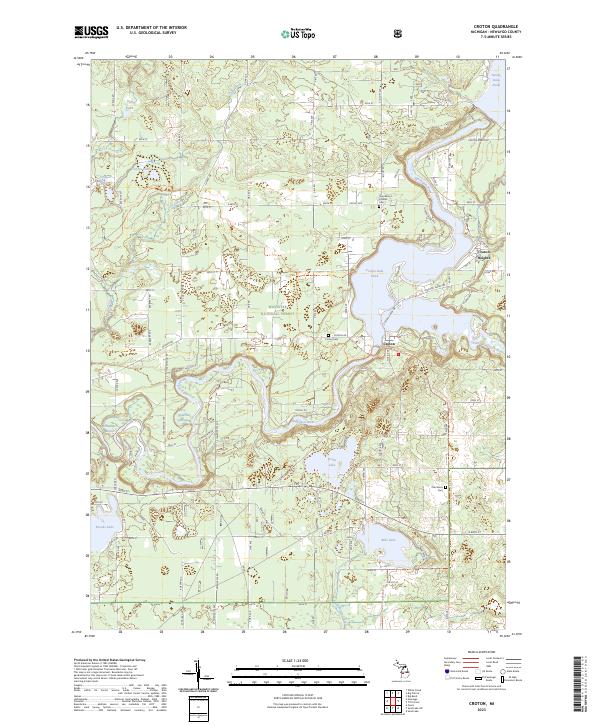
2023 Map of Croton
USGS Topo · Published 2023About this map
The confluence of the Muskegon River and the Little Muskegon River defines the landscape of this Newaygo County region. This area is characterized by significant hydroelectric impoundments, including the Hardy Dam Pond and Croton Dam Pond, which have fundamentally altered the river's path and local topography. The settlement of Croton and the nearby Croton Heights serve as central points for local history, surrounded by the protected woodlands of the Manistee National Forest. Extensive water bodies such as Pettit Lake, Bills Lake, and Brooks Lake dot the glacial terrain, illustrating the water-rich geography of western Michigan. Genealogists can find several established burial sites documented here, including the Croton Cem, Oak Grove Cem, and Saint Mary's Catholic Cem. For those exploring the outdoors, the North Country National Scenic Trl winds through the forest and across the river valleys.
Find a feature on this map
51 named features on this map. Tap any name to fly to it.
Don’t see what you’re looking for? This feature index may not catch every label — zoom into the map to look around manually.
Map Details
Editions of this 2023 Croton Map
This is the sole edition of this map. No revisions or reprints were ever made.
Other maps of this area

1954 · Midland
USGS Topo · 1:250,000

1958 · Midland
USGS Topo · 1:250,000

1958 · Sand Lake
USGS Topo · 1:62,500

1958 · Fremont
USGS Topo · 1:62,500

1958 · Woodville
USGS Topo · 1:62,500

1959 · Midland
USGS Topo · 1:250,000

1959 · White Cloud
USGS Topo · 1:62,500

1966 · Midland
USGS Topo · 1:250,000

1976 · White Cloud SE
USGS Topo · 1:24,000
1984 · Big Rapids
USGS Topo · 1:100,000