
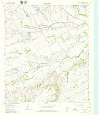
1962 Map of Cryer Creek
USGS Topo · Published 1965About this map
Chambers Creek meanders across this landscape south of the Ellis Co Navarro Co line, where the blackland prairie transitions into the complex drainage systems of north-central Texas. During the early 1960s, the rural character of the region was defined by scattered agrarian settlements like Rankin and Byrd, connected by a network of unimproved roads and the prominent route of the Chicago Fort Worth and Denver and Rock Island Pacific railroad. Near the southern edge, the eponymous Cryer Creek community is anchored by the Cryer Creek Cemetery, while the Grange Hall Cemetery and Antioch Church serve as vital genealogical markers for local families. The presence of the Flying Sams Airfield and numerous gravel pits suggests a diversification of land use alongside traditional ranching and farming, while several creeks like Mustang Creek and Onion Creek illustrate the natural irrigation patterns of the watershed.
Find a feature on this map
21 named features on this map. Tap any name to fly to it.
Don’t see what you’re looking for? This feature index may not catch every label — zoom into the map to look around manually.
Map Details
Editions of this 1962 Cryer Creek Map
2 editions found
Other maps of this area

1954 · Dallas
USGS Topo · 1:250,000

1956 · Ennis
USGS Topo · 1:62,500

1958 · Dallas
USGS Topo · 1:250,000

1961 · Forreston
USGS Topo · 1:24,000

1962 · Emhouse
USGS Topo · 1:24,000

1962 · Ennis West
USGS Topo · 1:24,000

1962 · Ennis East
USGS Topo · 1:24,000
1965 · Avalon
USGS Topo · 1:24,000
1965 · Blooming Grove
USGS Topo · 1:24,000
1965 · Corbet
USGS Topo · 1:24,000