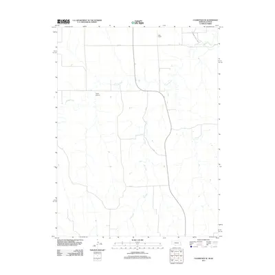
2011 Map of Culbertson SE
USGS Topo · Published 2011About this map
Elm Creek and Driftwood Creek dictate the landscape of this rural corridor along the Nebraska-Kansas border. The drainage patterns and topographic relief are most pronounced at Tipton Canyon, where the upland terrain breaks toward the creek bottoms. This 2011 survey captures the area's agricultural infrastructure, including the Driftwood West Canal which supports the region's irrigation needs. Aviation in this remote stretch of the plains is anchored by Hoyt Airport, situated on the northern plateau. The map details a geometric grid of local transit, including RD 710 and RD 375, which serve as the primary conduits for the scattered farmsteads and ranchlands that define Red Willow County.
Find a feature on this map
11 named features on this map. Tap any name to fly to it.
Don’t see what you’re looking for? This feature index may not catch every label — zoom into the map to look around manually.
Map Details
Editions of this 2011 Culbertson SE Map
This is the sole edition of this map. No revisions or reprints were ever made.
Other maps of this area

1951 · Herndon
USGS Topo · 1:62,500

1951 · Oberlin
USGS Topo · 1:62,500

1954 · McCook
USGS Topo · 1:250,000

1954 · Goodland
USGS Topo · 1:250,000

1956 · Goodland
USGS Topo · 1:250,000

1957 · McCook
USGS Topo · 1:250,000

1957 · Goodland
USGS Topo · 1:250,000

1957 · McCook SW
USGS Topo · 1:24,000

1958 · McCook
USGS Topo · 1:250,000

1962 · Culbertson NW
USGS Topo · 1:24,000