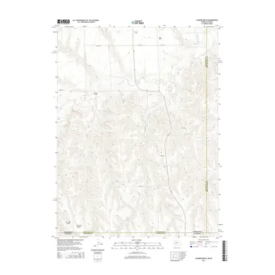
2014 Map of Culbertson SE
USGS Topo · Published 2014About this map
Driftwood Cr and the Driftwood Canal meander through this borderland where Nebraska meets Kansas. The landscape is defined by the sharp relief of northern canyons such as Tipton Canyon, transitioning into the deeper drainages of Burr Oak Canyon and East Oak Canyon at the southern boundary. This 2014 survey documents a sparsely settled agricultural and ranching region where section lines are marked by a grid of local roads, including Road 710 and Road 376. A focal point for local history is the Grove Cem in the north-central section, while aviation infrastructure is represented by Hoyt Airport. The map captures the meeting of three counties—Hitchcock and Red Willow in Nebraska, and Rawlins in Kansas—illustrating how topography and political boundaries intersect in this part of the Great Plains.
Find a feature on this map
18 named features on this map. Tap any name to fly to it.
Don’t see what you’re looking for? This feature index may not catch every label — zoom into the map to look around manually.
Map Details
Editions of this 2014 Culbertson SE Map
This is the sole edition of this map. No revisions or reprints were ever made.
Other maps of this area

1951 · Herndon
USGS Topo · 1:62,500

1951 · Oberlin
USGS Topo · 1:62,500

1954 · McCook
USGS Topo · 1:250,000

1954 · Goodland
USGS Topo · 1:250,000

1956 · Goodland
USGS Topo · 1:250,000

1957 · McCook
USGS Topo · 1:250,000

1957 · Goodland
USGS Topo · 1:250,000

1957 · McCook SW
USGS Topo · 1:24,000

1958 · McCook
USGS Topo · 1:250,000

1962 · Culbertson NW
USGS Topo · 1:24,000