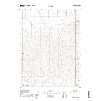
2017 Map of Culbertson SE
USGS Topo · Published 2017About this map
Driftwood Creek and its associated waterworks define this landscape along the Nebraska-Kansas border, where the High Plains transition into a network of deeply etched drainages. The map reveals the intricate water management of the region, specifically the Driftwood W Canal which skirts the Hitchcock and Red Willow County line. This agricultural territory is segmented by several prominent natural features, including the broad Tipton Canyon and the branching Burr Oak Canyon and East Oak Canyon to the southwest. Human presence is marked by isolated landmarks like the Grove Cemetery and Hoyt Airport, connected by a grid of rural county roads such as Co RD 710 and Co RD 375. The survey illustrates the persistence of the Public Land Survey System, showing how township lines like t1n r31w dictate the settlement patterns of this plains environment.
Find a feature on this map
29 named features on this map. Tap any name to fly to it.
Don’t see what you’re looking for? This feature index may not catch every label — zoom into the map to look around manually.
Map Details
Editions of this 2017 Culbertson SE Map
This is the sole edition of this map. No revisions or reprints were ever made.
Other maps of this area

1951 · Herndon
USGS Topo · 1:62,500

1951 · Oberlin
USGS Topo · 1:62,500

1954 · McCook
USGS Topo · 1:250,000

1954 · Goodland
USGS Topo · 1:250,000

1956 · Goodland
USGS Topo · 1:250,000

1957 · McCook
USGS Topo · 1:250,000

1957 · Goodland
USGS Topo · 1:250,000

1957 · McCook SW
USGS Topo · 1:24,000

1958 · McCook
USGS Topo · 1:250,000

1962 · Culbertson NW
USGS Topo · 1:24,000