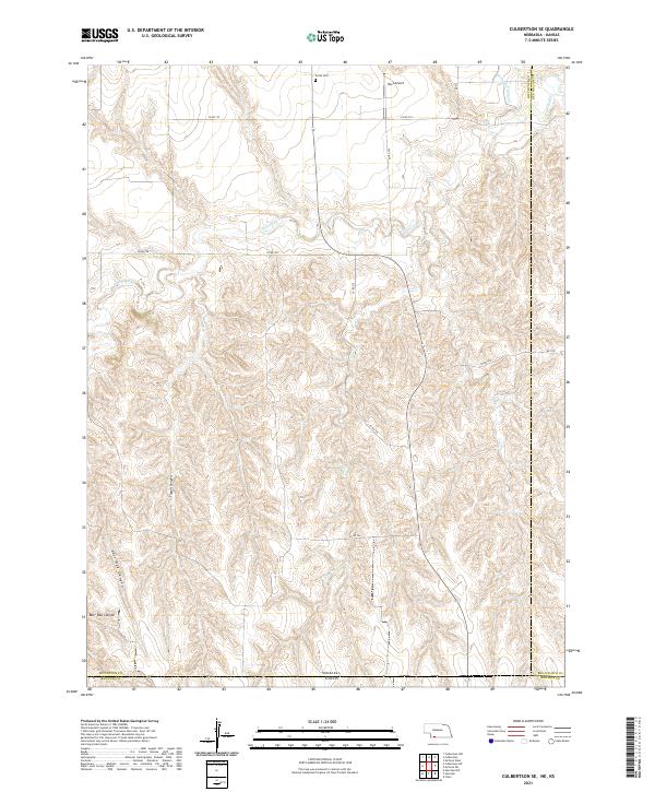
2021 Map of Culbertson SE
USGS Topo · Published 2021About this map
The high plains of the Nebraska-Kansas border define this landscape, where the deeply dissected terrain of Tipton Canyon and Burr Oak Canyon drops toward the drainage of Driftwood Cr. In this corner of Hitchcock County, the 2021 topography reveals a land-use pattern dominated by agriculture and water management, evidenced by the Driftwood W Canal cutting through the northern sections. Human presence is concentrated near the road networks like Co RD 710 and Co RD 708, which follow the section lines of the Public Land Survey System. Local history is anchored at the Grove Cem in the north-central portion of the map, while the Hoyt Airport serves as a modern landmark. The terrain transitions from high plateaus down into narrow creek valleys such as Elm Cr, illustrating the erosive forces that have shaped this portion of the Great Plains.
Find a feature on this map
25 named features on this map. Tap any name to fly to it.
Don’t see what you’re looking for? This feature index may not catch every label — zoom into the map to look around manually.
Map Details
Editions of this 2021 Culbertson SE Map
This is the sole edition of this map. No revisions or reprints were ever made.
Other maps of this area

1951 · Herndon
USGS Topo · 1:62,500

1951 · Oberlin
USGS Topo · 1:62,500

1954 · McCook
USGS Topo · 1:250,000

1954 · Goodland
USGS Topo · 1:250,000

1956 · Goodland
USGS Topo · 1:250,000

1957 · McCook
USGS Topo · 1:250,000

1957 · Goodland
USGS Topo · 1:250,000

1957 · McCook SW
USGS Topo · 1:24,000

1958 · McCook
USGS Topo · 1:250,000

1962 · Culbertson NW
USGS Topo · 1:24,000