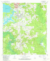
1981 Map of Cullen
USGS Topo · Published 1981About this map
Springhill and Cullen serve as the industrial anchors for this northern Louisiana landscape, where the Arkansas and Louisiana Missouri railroad connects timber and manufacturing hubs. The presence of a Paper Mill Pond and the extensive South Sarepta Oil and Gas Field reflect an economy deeply tied to the region's natural resources. Much of the western terrain is defined by the Bayou Bodcau Reservoir and the Bodcau State Wildlife Management Area, showing the controlled management of the local watershed across the Bossier Parish and Webster Parish line.
Find a feature on this map
48 named features on this map. Tap any name to fly to it.
Don’t see what you’re looking for? This feature index may not catch every label — zoom into the map to look around manually.
Map Details
Editions of this 1981 Cullen Map
2 editions found
Other maps of this area

1922 · Sarepta
USGS Topo · 1:62,500

1924 · Sarepta
USGS Topo · 1:62,500

1950 · Plain Dealing NE
USGS Topo · 1:31,680

1950 · Plain Dealing SE
USGS Topo · 1:31,680

1952 · Bradley SE
USGS Topo · 1:24,000

1953 · Carterville
USGS Topo · 1:24,000

1953 · El Dorado
USGS Topo · 1:250,000

1955 · Shreveport
USGS Topo · 1:250,000
1955 · Plain Dealing
USGS Topo · 1:62,500

1956 · Shreveport
USGS Topo · 1:250,000