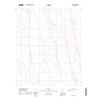
2023 Map of Culp Ranch
USGS Topo · Published 2023About this map
The arid high plains of Chaves County are defined here by a sparse network of ranching infrastructure and boundary lines. Centered on the eastern edge of the Pecos River valley, the landscape is organized by the Public Land Survey System, with the intersection of t11s r29e, t11s r30e, t12s r29e, and t12s r30e marking the division of these remote rangelands. Transport through the area is limited to local tracks and secondary corridors such as Inez Rd and Co Rd 57, which provide the primary access to private grazing lands. Water management is critical in this environment, evidenced by the presence of Adams Tank, a vital catchment for livestock that serves as one of the few named landmarks in this expansive New Mexico terrain.
Find a feature on this map
7 named features on this map. Tap any name to fly to it.
Don’t see what you’re looking for? This feature index may not catch every label — zoom into the map to look around manually.
Map Details
Editions of this 2023 Culp Ranch Map
This is the sole edition of this map. No revisions or reprints were ever made.
Other maps of this area

1949 · Sardine Mountain
USGS Topo · 1:24,000

1949 · Malstrom Ranch
USGS Topo · 1:24,000

1952 · Connor Well
USGS Topo · 1:24,000

1954 · Brownfield
USGS Topo · 1:250,000

1955 · Roswell
USGS Topo · 1:250,000

1958 · Brownfield
USGS Topo · 1:250,000

1958 · Roswell
USGS Topo · 1:250,000

1962 · Roswell
USGS Topo · 1:250,000

1962 · Brownfield
USGS Topo · 1:250,000

1973 · Culp Ranch
USGS Topo · 1:24,000