
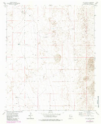
1973 Map of Culp Ranch
USGS Topo · Published 1976About this map
Culp Ranch occupies the northern reaches of this high desert landscape in Chaves County during the early 1970s. The terrain is defined by undulating topography and significant areas of Shifting Sand, highlighting the arid environment where water management was critical for survival and ranching operations. Scattered across the quadrangle are numerous engineering artifacts of the mid-century cattle industry, including Water Tanks, Adams Tank, and remote pumping stations like the Lone Wolf Windmills and Backus Windmill. The map reveals a network of utilitarian access, with a complex web of Jeep Trails connecting these isolated water sources. Evidence of subsurface exploration is also present via several marked Drill Holes, suggesting mineral or geological surveying activity that coincided with traditional land use.
Find a feature on this map
10 named features on this map. Tap any name to fly to it.
Don’t see what you’re looking for? This feature index may not catch every label — zoom into the map to look around manually.
Map Details
Editions of this 1973 Culp Ranch Map
2 editions found
Other maps of this area

1949 · Sardine Mountain
USGS Topo · 1:24,000

1949 · Malstrom Ranch
USGS Topo · 1:24,000

1952 · Connor Well
USGS Topo · 1:24,000

1954 · Brownfield
USGS Topo · 1:250,000

1955 · Roswell
USGS Topo · 1:250,000

1958 · Brownfield
USGS Topo · 1:250,000

1958 · Roswell
USGS Topo · 1:250,000

1962 · Roswell
USGS Topo · 1:250,000

1962 · Brownfield
USGS Topo · 1:250,000

1973 · Mescalero Point
USGS Topo · 1:24,000