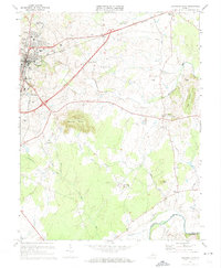
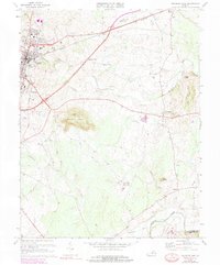
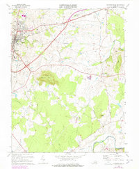
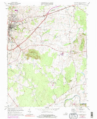
1973 Map of Culpeper East
USGS Topo · Published 1974About this map
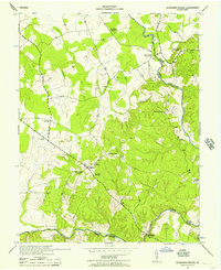
The Southern railroad corridor anchors this survey of central Virginia, where the urban edge of Culpeper meets the agricultural flats and ridges of the Piedmont. The landscape is dotted with small rural nodes like Braggs Corner, Greens Corner, and the settlement at Brandy Station. Local heritage is preserved in the detailed mapping of the Culpeper National Cem and the Masonic Cem, alongside several country houses of worship including St Stephens Ch and Poplar Ridge Ch.
Find a feature on this map
44 named features on this map. Tap any name to fly to it.
Don’t see what you’re looking for? This feature index may not catch every label — zoom into the map to look around manually.
Map Details
Editions of this 1973 Culpeper East Map
4 editions found
Other maps of this area

1887 · Spottsylvania
USGS Topo · 1:125,000

1892 · Spottsylvania
USGS Topo · 1:125,000

1892 · Gordonsville
USGS Topo · 1:125,000

1893 · Luray
USGS Topo · 1:125,000

1894 · Warrenton
USGS Topo · 1:125,000

1894 · Warrenton
USGS Topo · 1:62,500

1905 · Luray
USGS Topo · 1:125,000

1927 · Remington
USGS Topo · 1:48,000

1930 · Warrenton
USGS Topo · 1:62,500
1943 · Germanna Bridge
USGS Topo · 1:24,000