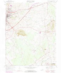
1973 Map of Culpeper East
USGS Topo · Published 1978About this map
Culpeper and its eastern outskirts are defined by the convergence of the Southern railroad and the rolling heights of Mount Pony. During the 1970s, the town's expansion is evident through newer developments like the County High Sch and a Drive-in Theater, while historical roots remain visible at the National Cem and Masonic Cem. To the east, the landscape transitions into agricultural land and small crossroads such as Braggs Corner and Greens Corner, punctuated by the winding course of Mountain Run. Local industry is represented by a large Quarry near St Stephens Ch, adjacent to the small Quarry Airport. The map also captures the historic site of Brandy Station in the northeast, a critical rail point situated along Jonas Run. The southern border follows the Rapidan River, marking the boundary between Culpeper and Orange counties.
Find a feature on this map
47 named features on this map. Tap any name to fly to it.
Don’t see what you’re looking for? This feature index may not catch every label — zoom into the map to look around manually.
Map Details
Editions of this 1973 Culpeper East Map
4 editions found
Other maps of this area

1887 · Spottsylvania
USGS Topo · 1:125,000

1892 · Spottsylvania
USGS Topo · 1:125,000

1892 · Gordonsville
USGS Topo · 1:125,000

1893 · Luray
USGS Topo · 1:125,000

1894 · Warrenton
USGS Topo · 1:125,000

1894 · Warrenton
USGS Topo · 1:62,500

1905 · Luray
USGS Topo · 1:125,000

1927 · Remington
USGS Topo · 1:48,000

1930 · Warrenton
USGS Topo · 1:62,500

1943 · Germanna Bridge
USGS Topo · 1:24,000