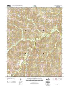
2013 Map of Cumberland
USGS Topo · Published 2013About this map
Cumberland and the surrounding rural landscape of Central Virginia are defined by a complex drainage system feeding into the Appomattox River. Small agricultural settlements like Sunny Side and Angola are connected by a network of winding roads, many of which bear the names of early local families and historical commerce, such as Mottley Mill Rd and Frenchs Store Rd. The terrain is deeply etched by numerous creeks, including Tear Wallet Cr and Big Guinea Cr, which dictated the placement of early homes and mills.
Find a feature on this map
73 named features on this map. Tap any name to fly to it.
Don’t see what you’re looking for? This feature index may not catch every label — zoom into the map to look around manually.
Map Details
Editions of this 2013 Cumberland Map
This is the sole edition of this map. No revisions or reprints were ever made.
Other maps of this area

1891 · Palmyra
USGS Topo · 1:125,000

1891 · Farmville
USGS Topo · 1:125,000

1893 · Farmville
USGS Topo · 1:125,000

1895 · Palmyra
USGS Topo · 1:125,000

1897 · Palmyra
USGS Topo · 1:125,000

1947 · Roanoke
USGS Topo · 1:250,000

1950 · Dillwyn
USGS Topo · 1:62,500

1958 · Farmville
USGS Topo · 1:62,500

1958 · Jetersville
USGS Topo · 1:62,500

1958 · Dillwyn
USGS Topo · 1:62,500