Loading...
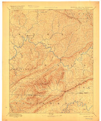
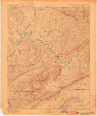
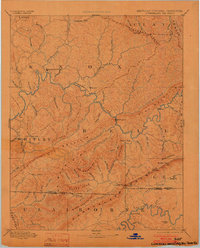
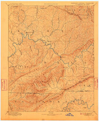
Loading map...1891 Map of Cumberland Gap
USGS Topo · Published 1917About this map
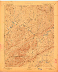
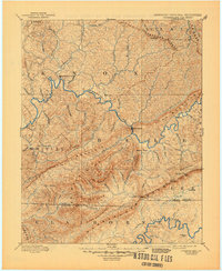
Cumberland River drainage patterns dominate this late 19th-century reconnaissance, capturing the vital gateway where Kentucky, Tennessee, and Virginia converge. The topography is defined by the sharp parallel ridges of Pine Mountain and the Kentucky Ridge, creating a natural corridor for early migration and settlement. The prominent Cumberland Gap and the nearby Pinnacle landmark overlook a landscape of deep hollows and named branches like Hance Branch and Williams Branch.
Find a feature on this map
75 named features on this map. Tap any name to fly to it.
Don’t see what you’re looking for? This feature index may not catch every label — zoom into the map to look around manually.
Map Details
Date Portrayed1891
Date Published1917
PublisherU.S. Geological Survey
Map TypeTopographic
Scale1:125,000
Physical Dimensions17 x 20.4 inches
Editions of this 1891 Cumberland Gap Map
7 editions found

Historical Maps of Middlesboro Through Time
4 maps found


Featured Locations
Source Details
SourceU.S. Geological Survey
CopyrightPublic Domain