Loading...
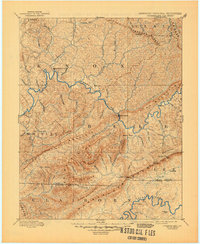
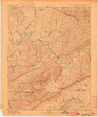
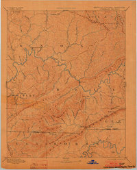
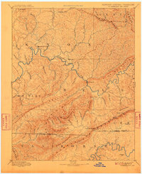
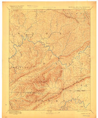
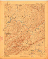
Loading map...1891 Map of Cumberland Gap
USGS Topo · Published 1945About this map
Cumberland River drainage and the towering ridges of the Southern Appalachians define this late 19th-century survey of the tri-state border region. Long before modern highways breached these mountains, travel relied on the ancient passage at Cumberland Gap and several strategic river crossings such as Yes Ferry, McHenry Ford, and Campbell Ford. The settlement pattern follows the narrow valley floors, with established communities like Barbourville and Pineville serving as focal points for the surrounding highland hollows.
Find a feature on this map
67 named features on this map. Tap any name to fly to it.
Don’t see what you’re looking for? This feature index may not catch every label — zoom into the map to look around manually.
Map Details
Date Portrayed1891
Date Published1945
PublisherU.S. Geological Survey
Map TypeTopographic
Scale1:125,000
Physical Dimensions17.3 x 21.2 inches
Editions of this 1891 Cumberland Gap Map
7 editions found

Historical Maps of Middlesboro Through Time
4 maps found


Featured Locations
Source Details
SourceU.S. Geological Survey
CopyrightPublic Domain