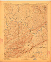
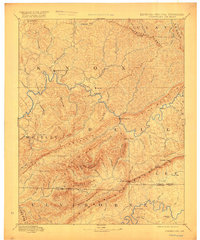
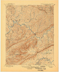
1891 Map of Cumberland Gap
USGS Topo · Published 1923About this map
The Cumberland River carves a winding path through this 1880s landscape, serving as the central artery for transportation and settlement in the tri-state area. Geographers Gilbert Thompson and S.S. Gannett documented a region defined by dramatic ridgelines, where passage was dictated by natural breaks like Cumberland Gap and Butcher Gap. Early river crossings were vital to the local economy, evidenced by Tyes Ferry and strategic points like McHenry Ford and Campbell Ford.
Find a feature on this map
84 named features on this map. Tap any name to fly to it.
Don’t see what you’re looking for? This feature index may not catch every label — zoom into the map to look around manually.
Map Details
Editions of this 1891 Cumberland Gap Map
7 editions found
Other maps of this area

1883 · Morristown
USGS Topo · 1:125,000

1886 · Cumberland Gap
USGS Topo · 1:125,000

1887 · Jonesville
USGS Topo · 1:125,000

1888 · Cumberland Gap
USGS Topo · 1:125,000

1890 · Williamsburg
USGS Topo · 1:125,000

1891 · Manchester
USGS Topo · 1:125,000

1891 · Cumberland Gap
USGS Topo · 1:125,000

1891 · Hazard
USGS Topo · 1:125,000

1891 · Jonesville
USGS Topo · 1:125,000

1893 · London
USGS Topo · 1:125,000