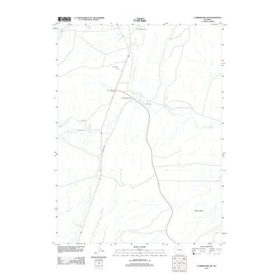
2012 Map of Cumberland Gap
USGS Topo · Published 2012About this map
Cumberland Cem sits north of the prominent Cumberland Gap in this portion of Uinta County, marking a site of local genealogical interest in an otherwise sparsely populated landscape. The area is defined by the winding paths of Little Muddy Cr and Albert Cr, which dictate the placement of local infrastructure and private holdings. Long-established ranching interests are evident through the presence of Ziller Ranch and the Company Ranch, while specialized structures like Storm Shelter Cabin Number 2 and Water Tank Number 8 point to the logistical requirements of managing this high-altitude terrain. The presence of Cumberland Rd and the Haul Rd suggests a landscape utilized for both regional transit and industrial access, while the area known as Carter Cedars provides a distinct geographical anchor in the southeastern portion of the quadrangle.
Find a feature on this map
13 named features on this map. Tap any name to fly to it.
Don’t see what you’re looking for? This feature index may not catch every label — zoom into the map to look around manually.
Map Details
Editions of this 2012 Cumberland Gap Map
This is the sole edition of this map. No revisions or reprints were ever made.
Other maps of this area

1954 · Ogden
USGS Topo · 1:250,000

1958 · Ogden
USGS Topo · 1:250,000

1960 · Ogden
USGS Topo · 1:250,000

1962 · Cumberland Gap
USGS Topo · 1:24,000

1962 · Elkol SW
USGS Topo · 1:24,000

1962 · Elkol
USGS Topo · 1:24,000

1962 · Warfield Creek
USGS Topo · 1:24,000

1964 · Carter
USGS Topo · 1:24,000

1965 · Bridger
USGS Topo · 1:24,000

1965 · Meadow Draw
USGS Topo · 1:24,000