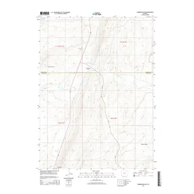
2015 Map of Cumberland Gap
USGS Topo · Published 2015About this map
The Cumberland Cem sits on a high bench overlooking the northern edge of Cumberland Gap, marking the human history of this high-altitude landscape. This corner of Southwest Wyoming is defined by sharp ridgelines like The Hogsback and the open expanses of Cumberland Flats. The area is bisected by the county line between Lincoln and Uinta Counties, showing a drainage network where N Fork Little Muddy Cr and Albert Cr carve through the high desert terrain. To the southeast, the juniper-dotted landscape of Carter Cedars provides a distinct geographical contrast. The presence of a Haul Rd cutting across the northwestern section indicates modern industrial or resource access within this traditional ranching and transit corridor.
Find a feature on this map
15 named features on this map. Tap any name to fly to it.
Don’t see what you’re looking for? This feature index may not catch every label — zoom into the map to look around manually.
Map Details
Editions of this 2015 Cumberland Gap Map
This is the sole edition of this map. No revisions or reprints were ever made.
Other maps of this area

1954 · Ogden
USGS Topo · 1:250,000

1958 · Ogden
USGS Topo · 1:250,000

1960 · Ogden
USGS Topo · 1:250,000

1962 · Cumberland Gap
USGS Topo · 1:24,000

1962 · Elkol SW
USGS Topo · 1:24,000

1962 · Elkol
USGS Topo · 1:24,000

1962 · Warfield Creek
USGS Topo · 1:24,000

1964 · Carter
USGS Topo · 1:24,000

1965 · Bridger
USGS Topo · 1:24,000

1965 · Meadow Draw
USGS Topo · 1:24,000