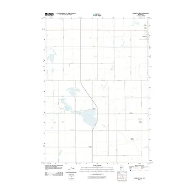
2010 Map of Current Lake
USGS Topo · Published 2010About this map
Current Lake and the agricultural lands of Lyon County dominate this prairie landscape during the early 21st century. The map reveals a region defined by its water management and religious heritage, with the Cottonwood River and Redwood River draining the tillable acreage. Significant local history is preserved in the numerous burial grounds scattered across the township, including Sillerud Cemetery, Skandia Cemetery, and Zion Lutheran Cemetery. The settlement of Balaton occupies the northeastern corner, serving as a hub for the surrounding farmstead grid. Natural depressions and drainage patterns are evident in features such as Hjermstad Slough and the Oscar Lakebed, reflecting the complex hydrology of this part of Minnesota. The strictly rectilinear road network, composed of routes like County Hwy-12 and 180th Ave, illustrates the enduring influence of the Public Land Survey System on the modern landscape.
Find a feature on this map
37 named features on this map. Tap any name to fly to it.
Don’t see what you’re looking for? This feature index may not catch every label — zoom into the map to look around manually.
Map Details
Editions of this 2010 Current Lake Map
This is the sole edition of this map. No revisions or reprints were ever made.
Other maps of this area

1953 · Watertown
USGS Topo · 1:250,000

1953 · New Ulm
USGS Topo · 1:250,000

1957 · New Ulm
USGS Topo · 1:250,000

1958 · New Ulm
USGS Topo · 1:250,000

1958 · Watertown
USGS Topo · 1:250,000

1963 · Dead Coon Lake
USGS Topo · 1:24,000

1963 · Russell
USGS Topo · 1:24,000

1963 · Marshall SE
USGS Topo · 1:24,000

1967 · New Ulm
USGS Topo · 1:250,000

1967 · Balaton
USGS Topo · 1:24,000