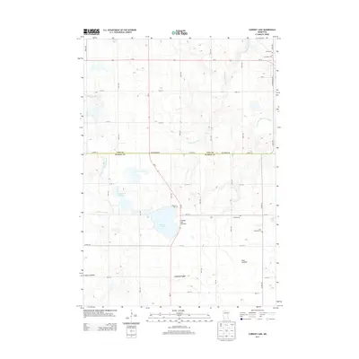
2013 Map of Current Lake
USGS Topo · Published 2013About this map
Coteau des Prairies, a vast upland plateau, dominates the geography of this rural landscape spanning the border of Lyon and Murray counties. The small community of Current Lake serves as a central point in a region defined by its hydrography and agricultural grid. Numerous rural burial grounds, including Sillerud Cem, Skandia Cem, and Zion Lutheran Cem, provide significant landmarks for genealogical research. The drainage patterns of the Redwood River and Cottonwood River are clearly visible, alongside unique features like the Oscar Lakebed and Ivadelle Lakebed, which suggest shifting environmental conditions in this prairie region. Modern infrastructure, including MN-91 and Us-14, bisects the townships, connecting the remote farmsteads and sloughs to the broader region during the early twenty-first century.
Find a feature on this map
43 named features on this map. Tap any name to fly to it.
Don’t see what you’re looking for? This feature index may not catch every label — zoom into the map to look around manually.
Map Details
Editions of this 2013 Current Lake Map
This is the sole edition of this map. No revisions or reprints were ever made.
Other maps of this area

1953 · Watertown
USGS Topo · 1:250,000

1953 · New Ulm
USGS Topo · 1:250,000

1957 · New Ulm
USGS Topo · 1:250,000

1958 · New Ulm
USGS Topo · 1:250,000

1958 · Watertown
USGS Topo · 1:250,000

1963 · Dead Coon Lake
USGS Topo · 1:24,000

1963 · Russell
USGS Topo · 1:24,000

1963 · Marshall SE
USGS Topo · 1:24,000

1967 · New Ulm
USGS Topo · 1:250,000

1967 · Balaton
USGS Topo · 1:24,000