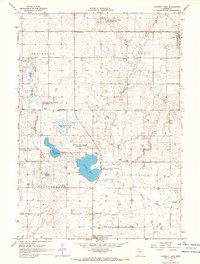
1967 Map of Current Lake
USGS Topo · Published 1968About this map
The Cottonwood River and Redwood River both headwater in this prairie landscape along the border of Lyon and Murray Counties. The village of Balaton sits in the northeast corner at the junction of the C & N W railroad, serving as a hub for the surrounding agricultural townships of Shelburne, Rock Lake, Ellsborough, and Skandia. This region is defined by its complex hydrology, featuring numerous wildlife management areas established around water bodies like Current Lake and Hjermstad Slough.
Find a feature on this map
30 named features on this map. Tap any name to fly to it.
Don’t see what you’re looking for? This feature index may not catch every label — zoom into the map to look around manually.
Map Details
Editions of this 1967 Current Lake Map
This is the sole edition of this map. No revisions or reprints were ever made.
Other maps of this area

1953 · Watertown
USGS Topo · 1:250,000

1953 · New Ulm
USGS Topo · 1:250,000

1957 · New Ulm
USGS Topo · 1:250,000

1958 · New Ulm
USGS Topo · 1:250,000

1958 · Watertown
USGS Topo · 1:250,000

1963 · Dead Coon Lake
USGS Topo · 1:24,000

1963 · Russell
USGS Topo · 1:24,000

1963 · Marshall SE
USGS Topo · 1:24,000

1967 · New Ulm
USGS Topo · 1:250,000

1967 · Balaton
USGS Topo · 1:24,000