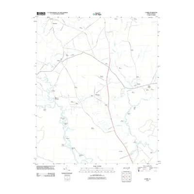
2010 Map of Currie
USGS Topo · Published 2010About this map
The Borough and Montague sit amidst a complex network of coastal plains drainage in this 2010 study of Pender County. The landscape is defined by the winding course of the Black River, which creates distinctive landforms like Birds Cove Island, Thorofare Island, and D Island. For genealogists and local historians, the sheet is exceptionally dense with family-named burial sites, ranging from the Chadwick Cemetery in the north near Yamacraw to the Malpass Cemetery and Henry Cemetery further south.
Find a feature on this map
77 named features on this map. Tap any name to fly to it.
Don’t see what you’re looking for? This feature index may not catch every label — zoom into the map to look around manually.
Map Details
Editions of this 2010 Currie Map
This is the sole edition of this map. No revisions or reprints were ever made.
Other maps of this area

1942 · Burgaw
USGS Topo · 1:62,500

1947 · Rocky Point
USGS Topo · 1:62,500

1953 · Florence
USGS Topo · 1:250,000

1953 · Beaufort
USGS Topo · 1:250,000

1954 · Florence
USGS Topo · 1:250,000

1954 · Beaufort
USGS Topo · 1:250,000

1954 · Acme
USGS Topo · 1:62,500

1955 · Atkinson
USGS Topo · 1:62,500
1970 · Castle Hayne
USGS Topo · 1:24,000
1970 · Rocky Point
USGS Topo · 1:24,000