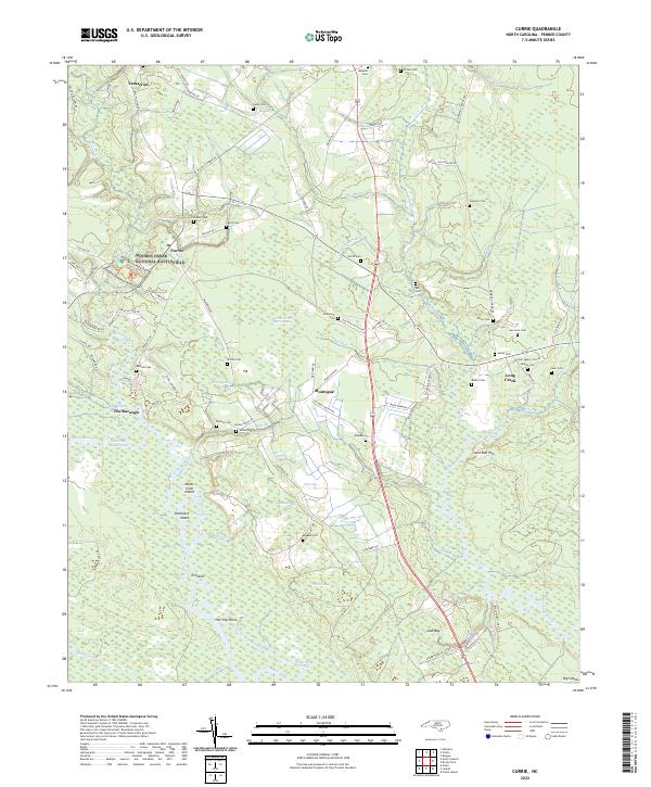
2022 Map of Currie
USGS Topo · Published 2022About this map
Moores Creek National Battlefield preserves the site of a pivotal early American Revolutionary War conflict, situated along the winding Moores Creek north of Currie. This Pender County landscape is defined by its intricate blackwater systems, where the Black River flows past numerous cypress-rich islands and coves like Birds Cove Island and Thorofare Island. The map reveals a high density of family cemeteries scattered across the lowlands, including the Lamb Cem, Walker Cem, and Malpass Cem, which serve as vital markers for local genealogical research.
Find a feature on this map
99 named features on this map. Tap any name to fly to it.
Don’t see what you’re looking for? This feature index may not catch every label — zoom into the map to look around manually.
Map Details
Editions of this 2022 Currie Map
This is the sole edition of this map. No revisions or reprints were ever made.
Other maps of this area

1942 · Burgaw
USGS Topo · 1:62,500

1947 · Rocky Point
USGS Topo · 1:62,500

1953 · Florence
USGS Topo · 1:250,000

1953 · Beaufort
USGS Topo · 1:250,000

1954 · Florence
USGS Topo · 1:250,000

1954 · Beaufort
USGS Topo · 1:250,000

1954 · Acme
USGS Topo · 1:62,500

1955 · Atkinson
USGS Topo · 1:62,500
1970 · Castle Hayne
USGS Topo · 1:24,000
1970 · Rocky Point
USGS Topo · 1:24,000