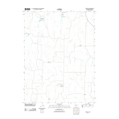
2011 Map of Curtis SE
USGS Topo · Published 2011About this map
Medicine Creek Reservoir 370 anchors the northwestern corner of this landscape in rural Frontier County, where a network of dams and reservoirs manages the drainage of the High Plains. The terrain is defined by the winding paths of Medicine Creek, Cedar Creek, and Spring Creek, which cut through the Nebraska prairie towards the Republican River basin. Settlement patterns here are reflected in the distributed legacy of rural education, with several numbered school sites such as School Number 75, School Number 82, and School Number 78 positioned throughout the township grid. Near the southern edge, the Lone Tree Cemetery serves as a quiet landmark for local family history. This 2011 survey documents a highly managed water system, featuring several land-use structures like the NE School Land Dam and Gilliland Dam Number 1 that support the region's agricultural character.
Find a feature on this map
20 named features on this map. Tap any name to fly to it.
Don’t see what you’re looking for? This feature index may not catch every label — zoom into the map to look around manually.
Map Details
Editions of this 2011 Curtis SE Map
This is the sole edition of this map. No revisions or reprints were ever made.
Other maps of this area

1902 · Gothenburg
USGS Topo · 1:125,000

1954 · McCook
USGS Topo · 1:250,000

1956 · Curtis SW
USGS Topo · 1:24,000

1956 · Moorefield
USGS Topo · 1:24,000

1956 · Curtis NW
USGS Topo · 1:24,000

1956 · Quick NE
USGS Topo · 1:24,000

1956 · Curtis
USGS Topo · 1:24,000

1956 · Curtis SE
USGS Topo · 1:24,000

1956 · Stockville
USGS Topo · 1:24,000

1956 · Bartley NW
USGS Topo · 1:24,000