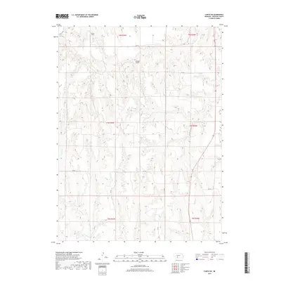
2017 Map of Curtis SW
USGS Topo · Published 2017About this map
Frontier Field sits atop the high plains of Frontier County in this 2017 survey, representing a landscape defined by the Public Land Survey System's geometric precision. The map details a transition between tablelands and deeply incised drainage systems, most notably Elkhorn Canyon which cuts through the northern sections. This rural geography is dominated by a grid of section roads including Rd 744 and Rd 381, providing essential access to the remote agricultural tracts of southwestern Nebraska. Seasonal waterways such as Spring Cr and Frazier Cr meander through the draws, illustrating the natural erosion patterns that have shaped these uplands over time. The cartography provides a clear look at the township and range boundaries that still govern property and land use in this part of the Great Plains.
Find a feature on this map
19 named features on this map. Tap any name to fly to it.
Don’t see what you’re looking for? This feature index may not catch every label — zoom into the map to look around manually.
Map Details
Editions of this 2017 Curtis SW Map
This is the sole edition of this map. No revisions or reprints were ever made.
Other maps of this area

1954 · McCook
USGS Topo · 1:250,000

1956 · White NE
USGS Topo · 1:24,000

1956 · Curtis SW
USGS Topo · 1:24,000

1956 · Curtis NW
USGS Topo · 1:24,000

1956 · Quick NE
USGS Topo · 1:24,000

1956 · Curtis
USGS Topo · 1:24,000

1956 · Curtis SE
USGS Topo · 1:24,000

1957 · McCook
USGS Topo · 1:250,000

1958 · McCook
USGS Topo · 1:250,000

1970 · Quick
USGS Topo · 1:24,000