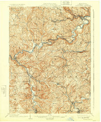
1903 Map of Curwensville
USGS Topo · Published 1924About this map
The West Branch Susquehanna River winds through the heart of Clearfield County, defining the early industrial and transportation character of this central Pennsylvania landscape. In the early twentieth century, the town of Curwensville served as a key hub where the Buffalo Rochester and Pittsburgh RR met the river, facilitating the movement of timber and coal from the surrounding hills. To the south and west, the rail network expanded through settlements like Lumber City and Mahaffey, following the tight curves of the river valley.
Find a feature on this map
97 named features on this map. Tap any name to fly to it.
Don’t see what you’re looking for? This feature index may not catch every label — zoom into the map to look around manually.
Map Details
Editions of this 1903 Curwensville Map
4 editions found
Other maps of this area

1902 · Patton
USGS Topo · 1:62,500

1902 · Barnesboro
USGS Topo · 1:62,500

1903 · Curwensville
USGS Topo · 1:62,500

1903 · Houtzdale
USGS Topo · 1:62,500

1904 · Barnesboro
USGS Topo · 1:62,500

1904 · Patton
USGS Topo · 1:62,500

1905 · Houtzdale
USGS Topo · 1:62,500

1906 · Punxsutawney
USGS Topo · 1:62,500

1920 · Altoona
USGS Topo · 1:62,500

1922 · Altoona
USGS Topo · 1:62,500