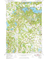
1948 Map of Cushing
USGS Topo · Published 1976About this map
The Burlington Northern railroad cuts a diagonal path through this landscape, connecting the villages of Cushing and Randall. This post-war survey reveals a rural society structured around one-room schoolhouses, with nearly two dozen scattered across the townships of Scandia Valley, Parker, and Fawn Lake. These small school districts, such as School No 137 (Willie School) and School No 29 (Fawn Lake School), represent a transition period in Minnesota's education history before the widespread consolidation of the 1950s.
Find a feature on this map
117 named features on this map. Tap any name to fly to it.
Don’t see what you’re looking for? This feature index may not catch every label — zoom into the map to look around manually.
Map Details
Editions of this 1948 Cushing Map
2 editions found
Other maps of this area

1916 · Pillager
USGS Topo · 1:62,500

1919 · Pillager
USGS Topo · 1:62,500

1947 · Flensburg
USGS Topo · 1:25,000

1948 · Belle Prairie
USGS Topo · 1:62,500

1948 · Cushing
USGS Topo · 1:62,500

1948 · Little Falls
USGS Topo · 1:62,500

1950 · Swanville
USGS Topo · 1:62,500

1950 · Belle Prairie
USGS Topo · 1:62,500

1950 · Little Falls
USGS Topo · 1:62,500

1950 · Cushing
USGS Topo · 1:62,500