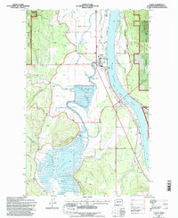
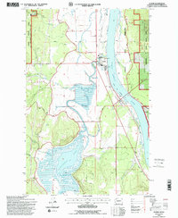
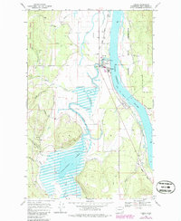
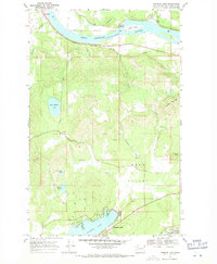
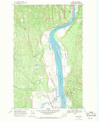
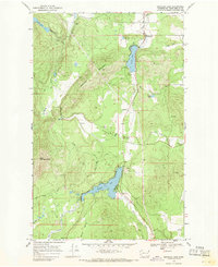
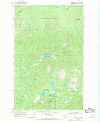
1992 Map of Cusick
USGS Topo · Published 1996About this map
The Pend Oreille River corridor dominates this northern Washington landscape, serving as the primary geographic anchor for the riverfront communities of Cusick and Usk. This 1990s-era documentation highlights the shared boundaries between the Kalispel Indian Reservation and the Kaniksu National Forest, illustrating a complex pattern of land management and cultural heritage. The western portion of the map is defined by the expansive wetlands of Calispell Lake and the meandering path of Calispell Creek, which flows through the Valley toward the river. Local civic life is represented by the County Fairground and Community Hall, while infrastructure such as the Gaging Station and Pumphouse indicates the ongoing management of the region's water resources. Recreational access is noted at the Batey Bould ORV Trailhead, reflecting the area's transition into a destination for forest-based activity.
Find a feature on this map
28 named features on this map. Tap any name to fly to it.
Don’t see what you’re looking for? This feature index may not catch every label — zoom into the map to look around manually.
Map Details
Editions of this 1992 Cusick Map
2 editions found
Other maps of this area

1936 · Newport
USGS Topo · 1:96,000

1942 · Newport
USGS Topo · 1:125,000

1958 · Sandpoint
USGS Topo · 1:250,000

1963 · Sandpoint
USGS Topo · 1:250,000
1968 · Cusick
USGS Topo · 1:24,000
1968 · Winchester Peak
USGS Topo · 1:24,000
1968 · Diamond Lake
USGS Topo · 1:24,000
1968 · Jared
USGS Topo · 1:24,000
1968 · Sacheen Lake
USGS Topo · 1:24,000
1968 · Browns Lake
USGS Topo · 1:24,000