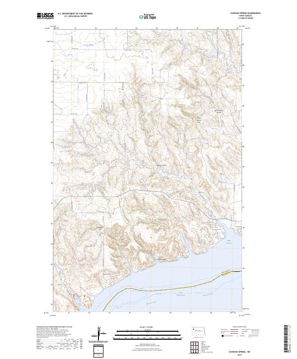
2024 Map of Cussicks Spring
USGS Topo · Published 2024About this map
The Missouri River and the sprawling waters of Lake Sakakawea define the southern reaches of this Williams County landscape, marking the boundary with McKenzie County. The terrain is characterized by a complex network of drainages and named coulees that feed into the river system, including Cedar Coulee and Stone Johnny Coulee. Water sources are vital landmarks in this high plains environment, evidenced by named features such as Cussicks Spring, Murt Adams Spring, and Hungry Gulch Spring.
Find a feature on this map
25 named features on this map. Tap any name to fly to it.
Don’t see what you’re looking for? This feature index may not catch every label — zoom into the map to look around manually.
Map Details
Editions of this 2024 Cussicks Spring Map
This is the sole edition of this map. No revisions or reprints were ever made.
Other maps of this area

1911 · Ray
USGS Topo · 1:125,000

1953 · Williston
USGS Topo · 1:250,000

1957 · Williston
USGS Topo · 1:250,000

1969 · Cussicks Spring
USGS Topo · 1:24,000

1969 · Red Mike Hill
USGS Topo · 1:24,000

1978 · Ray
USGS Topo · 1:24,000

1978 · Tobacco Garden Bay
USGS Topo · 1:24,000

1978 · Ray SE
USGS Topo · 1:24,000

1978 · Epping
USGS Topo · 1:24,000
1978 · Banks
USGS Topo · 1:24,000