
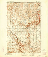
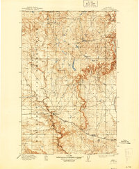
1912 Map of Cut Bank
USGS Topo · Published 1912About this map
The Blackfeet Indian Reservation dominates the western half of this northern Montana landscape, defined by a complex network of glacial coulees and high plains. The Great Northern R R serves as the primary artery of commerce and settlement, anchoring the town of Cut Bank where it crosses the deep drainage of the same name. Small railroad sidings and stops like Baltic and Simla trace the path of the tracks toward the Sweetgrass Hills to the east.
Find a feature on this map
37 named features on this map. Tap any name to fly to it.
Don’t see what you’re looking for? This feature index may not catch every label — zoom into the map to look around manually.
Map Details
Editions of this 1912 Cut Bank Map
3 editions found
Other maps of this area

1907 · Blackfoot Res.
USGS Topo · 1:48,000

1909 · Cut Bank
USGS Topo · 1:125,000

1911 · Blackfoot
USGS Topo · 1:125,000

1914 · Heart Butte
USGS Topo · 1:125,000

1918 · Heart Butte
USGS Topo · 1:125,000

1920 · Dupuyer
USGS Topo · 1:125,000

1920 · Conrad
USGS Topo · 1:125,000

1934 · Lake Frances
USGS Topo · 1:48,000

1934 · Valier
USGS Topo · 1:62,500

1937 · Valier
USGS Topo · 1:62,500
Featured Places
- Cut Bank, MT
- Ethridge, MT
- Hillside Hutterite Colony, MT
- Horizon Hutterite Colony, MT
- Glacier Hutterite Colony, MT