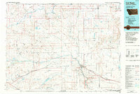
1984 Map of Cut Bank
USGS Topo · Published 1984About this map
The Blackfeet Indian Reservation dominates the western half of this Montana landscape, where the high plains meet the intricate drainages of the Milk River and Cut Bank Creek. In the mid-1980s, the region was defined by a mix of agricultural colonies, such as Hillside Colony and Glacier Colony, and an active energy sector indicated by the Reagan Camp Oil Field and Red Creek Oil Field. The town of Cut Bank serves as the primary hub, situated where the Burlington Northern railroad crosses the creek of the same name. Industrial infrastructure like a Refinery and several Gravel Pits contrast with the natural coulee systems, including Big Rock Coulee and Kennedy Coulee, which carve through the terrain. To the north, the international boundary at the Del Bonita Port of Entry marks the transition into Alberta, while landmarks like Landslide Butte and Square Butte rise above the surrounding flats.
Find a feature on this map
87 named features on this map. Tap any name to fly to it.
Don’t see what you’re looking for? This feature index may not catch every label — zoom into the map to look around manually.
Map Details
Editions of this 1984 Cut Bank Map
This is the sole edition of this map. No revisions or reprints were ever made.
Other maps of this area

1901 · Browning
USGS Topo · 1:125,000

1903 · Browning
USGS Topo · 1:125,000

1907 · Blackfoot Res.
USGS Topo · 1:48,000

1909 · Cut Bank
USGS Topo · 1:125,000

1911 · Blackfoot
USGS Topo · 1:125,000

1912 · Cut Bank
USGS Topo · 1:125,000

1913 · Marias Pass
USGS Topo · 1:125,000

1914 · Heart Butte
USGS Topo · 1:125,000

1918 · Heart Butte
USGS Topo · 1:125,000

1920 · Dupuyer
USGS Topo · 1:125,000