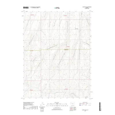
2019 Map of Cutoff Gulch
USGS Topo · Published 2019About this map
Barnes Ridge stands as a prominent geographic divide in this high-elevation corner of Western Colorado, situated along the county line between Rio Blanco and Garfield counties. The landscape is defined by an intricate network of drainage systems, most notably the numerous forks of Stewart Gulch that carve through the terrain. In this arid environment, isolated water sources like Bragg Spring, Crouch Spring, and Barnes Spring serve as critical landmarks for land management and local history. To the south, the terrain descends toward the W Fork Parachute Cr, while various named gulches such as Connley Gulch and Litchliter Gulch illustrate the highly dissected nature of the plateau. Davis Point provides a significant vantage over the southern reaches of the quadrangle, marking the transition into the Parachute Creek watershed.
Find a feature on this map
31 named features on this map. Tap any name to fly to it.
Don’t see what you’re looking for? This feature index may not catch every label — zoom into the map to look around manually.
Map Details
Editions of this 2019 Cutoff Gulch Map
This is the sole edition of this map. No revisions or reprints were ever made.
Other maps of this area

1925 · Parachute Creek
USGS Topo · 1:62,500

1927 · Parachute Creek
USGS Topo · 1:62,500

1929 · Highmore
USGS Topo · 1:62,500

1952 · Rock School
USGS Topo · 1:24,000

1952 · Jessup Gulch
USGS Topo · 1:24,000

1952 · No Name Ridge
USGS Topo · 1:24,000

1956 · Grand Junction
USGS Topo · 1:250,000

1959 · Grand Junction
USGS Topo · 1:250,000

1960 · Grand Junction
USGS Topo · 1:250,000

1962 · Grand Junction
USGS Topo · 1:250,000