
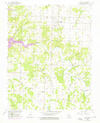
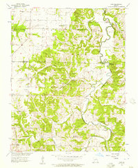
1955 Map of Dadeville
USGS Topo · Published 1957About this map
Sac River dominates the central landscape of this mid-century topographic record, winding through the townships of South Morgan and Polk. The 1950s terrain is marked by a network of rural crossroads and community anchors, including the hub of Dadeville and the smaller settlement at Corry. Genealogists will find a wealth of local markers, from family-named burial grounds like Pemberton Cem and Rice Cem to the Masonic Cem.
Find a feature on this map
31 named features on this map. Tap any name to fly to it.
Don’t see what you’re looking for? This feature index may not catch every label — zoom into the map to look around manually.
Map Details
Editions of this 1955 Dadeville Map
2 editions found
Other maps of this area

1886 · Stockton
USGS Topo · 1:125,000

1886 · Greenfield
USGS Topo · 1:125,000

1888 · Greenfield
USGS Topo · 1:125,000

1954 · Springfield
USGS Topo · 1:250,000

1956 · Ash Grove
USGS Topo · 1:24,000
1956 · Walnut Grove
USGS Topo · 1:24,000

1956 · Greenfield
USGS Topo · 1:24,000
1956 · Bona
USGS Topo · 1:24,000
1956 · South Greenfield
USGS Topo · 1:24,000
1956 · Crisp
USGS Topo · 1:24,000