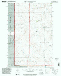
1997 Map of Daglum NW
USGS Topo · Published 2001About this map
Little Missouri National Grassland dominates this landscape along the border of Billings and Stark counties, revealing a topography defined by complex drainages and remote prairie outposts in the late 1990s. The small community of Gaylord and the Swenson Ranch serve as primary points of human settlement amidst the expansive terrain of Peaceful Valley. Local religious life is centered at Our Lady of Lourdes Ch, which is accompanied by a nearby Cem.
Find a feature on this map
18 named features on this map. Tap any name to fly to it.
Don’t see what you’re looking for? This feature index may not catch every label — zoom into the map to look around manually.
Map Details
Editions of this 1997 Daglum NW Map
This is the sole edition of this map. No revisions or reprints were ever made.
Other maps of this area

1953 · Dickinson
USGS Topo · 1:250,000

1957 · Dickinson
USGS Topo · 1:250,000

1961 · Daglum
USGS Topo · 1:62,500

1961 · Rocky Ridge
USGS Topo · 1:62,500

1962 · Belfield SW
USGS Topo · 1:24,000

1962 · Fryburg
USGS Topo · 1:24,000

1962 · Belfield SE
USGS Topo · 1:24,000

1980 · Belfield
USGS Topo · 1:100,000
1982 · Daglum NW
USGS Topo · 1:24,000
1982 · Daglum SW
USGS Topo · 1:24,000