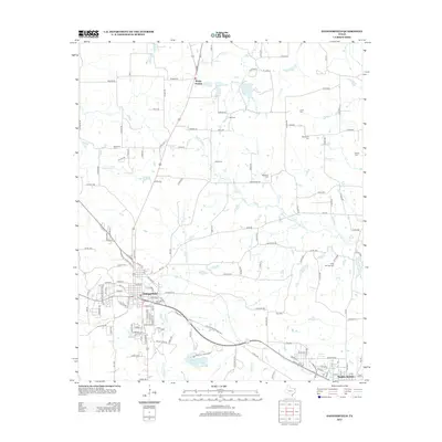
2013 Map of Daingerfield
USGS Topo · Published 2013About this map
Daingerfield serves as the central hub of this East Texas landscape, positioned just north of the expansive Daingerfield State Park-Lake. The map illustrates a rural area defined by a dense network of country roads and family-named landmarks, reflecting generations of land ownership. Numerous small cemeteries, such as Whitmore Cem, Hall Cem, and Jones Cem, are scattered across the terrain, offering significant value for genealogical research. The local hydrology is dominated by Black Cypress Cr and its tributaries, including Brutons Cr and Arbery Br. To the north, the community of Rocky Branch sits near several private water bodies like Jerome Wolfson Lake, while the southeastern corner reaches toward Hughes Springs. This modern topographic study documents the persistent rural character of Morris County, where residential clusters follow historic road alignments like FM-161.
Find a feature on this map
146 named features on this map. Tap any name to fly to it.
Don’t see what you’re looking for? This feature index may not catch every label — zoom into the map to look around manually.
Map Details
Editions of this 2013 Daingerfield Map
This is the sole edition of this map. No revisions or reprints were ever made.
Other maps of this area

1914 · Daingerfield
USGS Topo · 1:62,500

1953 · Texarkana
USGS Topo · 1:250,000

1956 · Texarkana
USGS Topo · 1:250,000

1956 · Tyler
USGS Topo · 1:250,000

1960 · La Fayette
USGS Topo · 1:24,000

1962 · Avinger
USGS Topo · 1:24,000

1962 · Lone Star
USGS Topo · 1:24,000

1964 · Daingerfield
USGS Topo · 1:24,000

1964 · Cason
USGS Topo · 1:24,000

1965 · Marietta
USGS Topo · 1:24,000