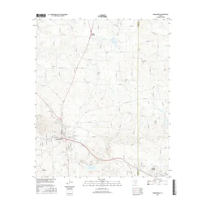
2016 Map of Daingerfield
USGS Topo · Published 2016About this map
Daingerfield serves as the focal point of this northeast Texas landscape, situated where the wooded terrain of the Black Mountains meets a network of vital waterways. The area is defined by its deep community roots, evidenced by the numerous family and community burial grounds such as Whitmore Cem, Bethlehem Cem, and Jones Cem that dot the countryside. North of the town center, the settlement of Rocky Branch sits near the headwaters of Black Cypress Cr, while the southern reaches of the map are anchored by the recreation-focused Daingerfield State Park Lake. The map reveals a transition between established residential streets in the town and the rural road networks that connect smaller water bodies like Jerome Wolfson Lake and Minor Lake. This geographic survey captures the persistence of early settlement patterns through the preservation of named landmarks and creek branches.
Find a feature on this map
123 named features on this map. Tap any name to fly to it.
Don’t see what you’re looking for? This feature index may not catch every label — zoom into the map to look around manually.
Map Details
Editions of this 2016 Daingerfield Map
This is the sole edition of this map. No revisions or reprints were ever made.
Other maps of this area

1914 · Daingerfield
USGS Topo · 1:62,500

1953 · Texarkana
USGS Topo · 1:250,000

1956 · Texarkana
USGS Topo · 1:250,000

1956 · Tyler
USGS Topo · 1:250,000

1960 · La Fayette
USGS Topo · 1:24,000

1962 · Avinger
USGS Topo · 1:24,000

1962 · Lone Star
USGS Topo · 1:24,000

1964 · Daingerfield
USGS Topo · 1:24,000

1964 · Cason
USGS Topo · 1:24,000

1965 · Marietta
USGS Topo · 1:24,000