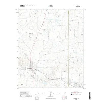
2019 Map of Daingerfield
USGS Topo · Published 2019About this map
Daingerfield serves as the focal point of this northeast Texas landscape, situated at the junction of several key regional routes and the Tower rail line. The town's grid is dense with named streets like W W M Watson Blvd and E Mc Reynolds St, leading south toward the recreational waters of Daingerfield State Park Lake. To the northeast, the settlement of Rocky Branch and the edge of Hughes Springs define the settled corridors of Morris and Cass counties.
Find a feature on this map
129 named features on this map. Tap any name to fly to it.
Don’t see what you’re looking for? This feature index may not catch every label — zoom into the map to look around manually.
Map Details
Editions of this 2019 Daingerfield Map
This is the sole edition of this map. No revisions or reprints were ever made.
Other maps of this area

1914 · Daingerfield
USGS Topo · 1:62,500

1953 · Texarkana
USGS Topo · 1:250,000

1956 · Texarkana
USGS Topo · 1:250,000

1956 · Tyler
USGS Topo · 1:250,000

1960 · La Fayette
USGS Topo · 1:24,000

1962 · Avinger
USGS Topo · 1:24,000

1962 · Lone Star
USGS Topo · 1:24,000

1964 · Daingerfield
USGS Topo · 1:24,000

1964 · Cason
USGS Topo · 1:24,000

1965 · Marietta
USGS Topo · 1:24,000