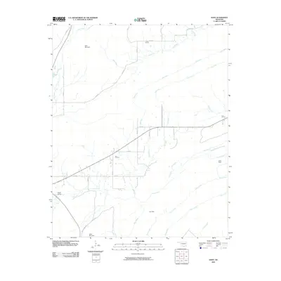
2009 Map of Daisy
USGS Topo · Published 2009About this map
The Indian Nation Tpke cuts a modern path through this corner of Oklahoma, contrasting with the longstanding rural landmarks that define the landscape. This terrain is characterized by prominent high points such as Bald Mountain in the north and Daisy Mountain to the south, with the drainage network of Buck Creek and Fobb Creek carving through the valleys. The map preserves the locations of several community burial grounds, including Billy Cemetery and Vivian Cemetery, which serve as vital touchstones for family historians. From the geological marker at Lone Rock to the descriptive Happy Hollow, the names on this 2009 survey reflect a deeply rooted agricultural and timber-adjacent character. Local travel is facilitated by a grid of numbered and named routes like Jumbo Rd and Feed Rd, linking the scattered homesteads and small gaps in the hills.
Find a feature on this map
34 named features on this map. Tap any name to fly to it.
Don’t see what you’re looking for? This feature index may not catch every label — zoom into the map to look around manually.
Map Details
Editions of this 2009 Daisy Map
This is the sole edition of this map. No revisions or reprints were ever made.
Other maps of this area

1898 · McAlester
USGS Topo · 1:125,000

1901 · Antlers
USGS Topo · 1:125,000

1909 · Mc Alester
USGS Topo · 1:125,000

1912 · Antlers
USGS Topo · 1:125,000

1925 · Antlers
USGS Topo · 1:125,000

1950 · Mcalester
USGS Topo · 1:250,000

1957 · Jumbo
USGS Topo · 1:24,000

1957 · Lane NE
USGS Topo · 1:24,000

1962 · McAlester
USGS Topo · 1:250,000

1965 · McAlester
USGS Topo · 1:250,000