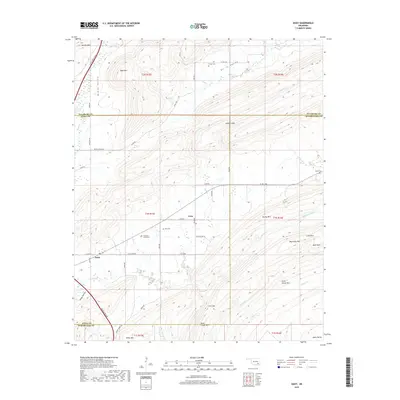
2019 Map of Daisy
USGS Topo · Published 2019About this map
Goss and Daisy anchor this intersection of several mountain ridges and creek valleys where Atoka, Pittsburg, and Pushmataha counties meet. The landscape is defined by the high elevations of Jackfork Mtn and Big Caney Mtn, with the Indian Nation Tpk cutting through the western corridor near McGee Valley. Local history is preserved in small family and community burial grounds, including Vivian Cem, Billy Cem, and Mountain Home Cem, often located near the winding rural roads like Burris Valley Rd. The map illustrates a complex drainage network where Buck Cr, Clear Cr, and Caney Cr flow between distinctive rock formations such as Lone Rock and the area known as Rock Town. These features suggest a settlement pattern dictated by the challenging topography of the Ouachita foothills.
Find a feature on this map
64 named features on this map. Tap any name to fly to it.
Don’t see what you’re looking for? This feature index may not catch every label — zoom into the map to look around manually.
Map Details
Editions of this 2019 Daisy Map
This is the sole edition of this map. No revisions or reprints were ever made.
Other maps of this area

1898 · McAlester
USGS Topo · 1:125,000

1901 · Antlers
USGS Topo · 1:125,000

1909 · Mc Alester
USGS Topo · 1:125,000

1912 · Antlers
USGS Topo · 1:125,000

1925 · Antlers
USGS Topo · 1:125,000

1950 · Mcalester
USGS Topo · 1:250,000

1957 · Jumbo
USGS Topo · 1:24,000

1957 · Lane NE
USGS Topo · 1:24,000

1962 · McAlester
USGS Topo · 1:250,000

1965 · McAlester
USGS Topo · 1:250,000