
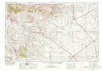
1954 Map of Dalhart
USGS Topo · Published 1967About this map
Capulin Mountain and the high volcanic peaks of Sierra Grande anchor the northwestern corner of this High Plains landscape, where the borders of New Mexico, Colorado, Oklahoma, and Texas converge. The map documents a mid-century cattle and energy economy, scattered with numerous windmills and emerging gas wells across the shortgrass prairie. Transportation is defined by the intersection of major rail lines like the Colorado and Southern and the Chicago Rock Island & Pacific, which served as the lifeblood for regional hubs like Dalhart and Clayton.
Find a feature on this map
61 named features on this map. Tap any name to fly to it.
Don’t see what you’re looking for? This feature index may not catch every label — zoom into the map to look around manually.
Map Details
Editions of this 1954 Dalhart Map
2 editions found
Other maps of this area

1891 · Springfield
USGS Topo · 1:125,000

1891 · Mesa De Maya
USGS Topo · 1:125,000

1892 · Vilas
USGS Topo · 1:125,000

1892 · Elmoro
USGS Topo · 1:125,000

1892 · Mt Carrizo
USGS Topo · 1:125,000

1893 · Elmoro
USGS Topo · 1:125,000

1893 · Springfield
USGS Topo · 1:125,000

1893 · Mesa de Maya
USGS Topo · 1:125,000

1897 · Elmoro
USGS Topo · 1:125,000

1954 · Santa Fe
USGS Topo · 1:250,000