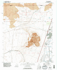
1991 Map of Dalies
USGS Topo · Published 1996About this map
El Cerro de los Lunas dominates the central landscape of this Valencia County quadrangle, rising above a complex network of historic Spanish land grants and modern irrigation systems. The map illustrates the convergence of several large ancestral tracts, including the San Clemente Grant, the Nicolas Duran de Chavez Grant, and the Antonio Guttierez and Joaquin Sedillo Grant. These traditional boundaries intersect with the southern edge of the Isleta Pueblo Indian Reservation and the small settlement of Paquita.
Find a feature on this map
29 named features on this map. Tap any name to fly to it.
Don’t see what you’re looking for? This feature index may not catch every label — zoom into the map to look around manually.
Map Details
Editions of this 1991 Dalies Map
2 editions found
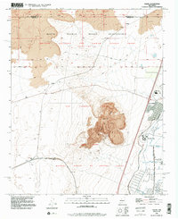
Other maps of this area

1952 · Wind Mesa
USGS Topo · 1:24,000

1952 · Dalies
USGS Topo · 1:24,000

1952 · Belen
USGS Topo · 1:24,000

1952 · Belen NW
USGS Topo · 1:24,000

1952 · Rio Puerco
USGS Topo · 1:24,000

1952 · Tome
USGS Topo · 1:24,000

1952 · Los Lunas
USGS Topo · 1:24,000

1952 · Isleta
USGS Topo · 1:24,000

1952 · Dalies NW
USGS Topo · 1:24,000

1954 · Socorro
USGS Topo · 1:250,000