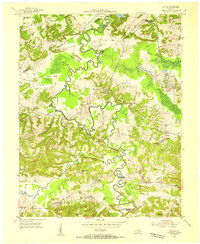
1954 Map of Dalton
USGS Topo · Published 1955About this map
The Tradewater River carves a highly sinuous path through this rural landscape at the intersection of Caldwell, Webster, and Hopkins counties. The winding river valley is defined by numerous river crossings and riparian landmarks such as Tayloe Bend, Tom Gray Ford, and the Montgomery Bridge. To the northeast, the Illinois Central railroad cuts through the terrain near Stony Point Ridge, supporting local industrial activity evidenced by the Hark and Hart Mine and various tipples. Small rural communities and church-centered settlements like Dalton, Poe, and Kirkwood Springs anchor the social geography of the era. The land is characterized by a dense network of ridges including Hickory Ridge and Poplar Ridge, while numerous small family and community burial grounds like Eaker Cem and Trailer Cem are scattered across the hillsides, offering significant detail for genealogical research.
Find a feature on this map
64 named features on this map. Tap any name to fly to it.
Don’t see what you’re looking for? This feature index may not catch every label — zoom into the map to look around manually.
Map Details
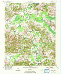
Editions of this 1954 Dalton Map
2 editions found
Other maps of this area

1907 · Earlington
USGS Topo · 1:48,000

1908 · Princeton
USGS Topo · 1:62,500

1909 · Dawson Springs
USGS Topo · 1:48,000

1909 · Earlington
USGS Topo · 1:62,500

1909 · Providence
USGS Topo · 1:62,500

1910 · Princeton
USGS Topo · 1:62,500

1911 · Dawson Springs
USGS Topo · 1:62,500

1954 · Evansville
USGS Topo · 1:250,000
1954 · Nebo
USGS Topo · 1:24,000
1954 · Shady Grove
USGS Topo · 1:24,000