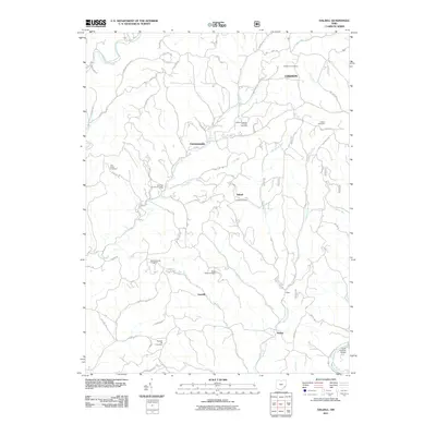
2011 Map of Dalzell
USGS Topo · Published 2011About this map
Hune Covered Bridge spans the Little Muskingum River in the southeastern corner of this Washington County landscape, a notable landmark in an area defined by deep valleys and high ridges. The settlement pattern here follows the drainage of numerous winding waterways, including Pawpaw Creek, Fifteenmile Creek, and the East Fork Duck Creek. Small rural centers such as Germantown, Dalzell, and Gasville are connected by a network of township roads and ridgeside lanes like Tick Ridge Rd and Neiff Ridge Rd.
Find a feature on this map
54 named features on this map. Tap any name to fly to it.
Don’t see what you’re looking for? This feature index may not catch every label — zoom into the map to look around manually.
Map Details
Editions of this 2011 Dalzell Map
This is the sole edition of this map. No revisions or reprints were ever made.
Other maps of this area

1903 · Macksburg
USGS Topo · 1:62,500

1904 · Marietta
USGS Topo · 1:62,500

1905 · New Matamoras
USGS Topo · 1:62,500

1905 · Macksburg
USGS Topo · 1:62,500

1906 · Saint Marys
USGS Topo · 1:62,500

1924 · St Marys
USGS Topo · 1:62,500

1924 · New Matamoras
USGS Topo · 1:62,500

1924 · Marietta
USGS Topo · 1:62,500

1926 · New Matamoras
USGS Topo · 1:62,500

1927 · Marietta
USGS Topo · 1:62,500