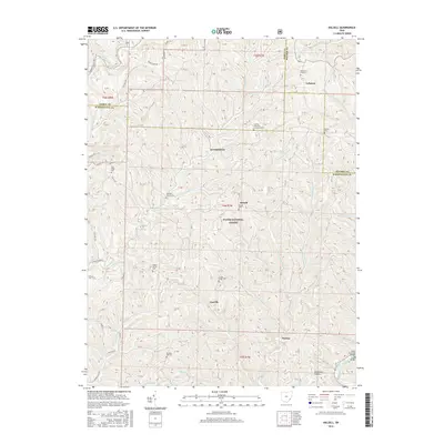
2016 Map of Dalzell
USGS Topo · Published 2016About this map
Wayne National Forest encompasses a significant portion of this landscape, where the borders of Washington, Noble, and Monroe counties converge. The terrain is defined by a dense network of creek valleys and ridges, with settlements such as Dalzell and Gasville situated along the winding paths of Pawpaw Cr and Fifteenmile Cr. The map reveals a deeply rooted rural community, marked by numerous hilltop cemeteries and country churches, including Waxler Church Cem and Liberty Township Christian Cem.
Find a feature on this map
54 named features on this map. Tap any name to fly to it.
Don’t see what you’re looking for? This feature index may not catch every label — zoom into the map to look around manually.
Map Details
Editions of this 2016 Dalzell Map
This is the sole edition of this map. No revisions or reprints were ever made.
Other maps of this area

1903 · Macksburg
USGS Topo · 1:62,500

1904 · Marietta
USGS Topo · 1:62,500

1905 · New Matamoras
USGS Topo · 1:62,500

1905 · Macksburg
USGS Topo · 1:62,500

1906 · Saint Marys
USGS Topo · 1:62,500

1924 · St Marys
USGS Topo · 1:62,500

1924 · New Matamoras
USGS Topo · 1:62,500

1924 · Marietta
USGS Topo · 1:62,500

1926 · New Matamoras
USGS Topo · 1:62,500

1927 · Marietta
USGS Topo · 1:62,500