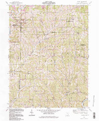
1994 Map of Dalzell
USGS Topo · Published 1998About this map
The Wayne National Forest covers much of this landscape in Washington and Noble Counties, where the terrain is deeply incised by the Fifteenmile Creek and Duck Creek watersheds. This late-twentieth-century update shows a rural landscape defined by historic land divisions, including the North Boundary Donation Tract and the First Boundary Old Seven Ranges. Small, persistent settlements like Dalzell, Germantown, and Lebanon serve as local anchors, while dozens of active Gas Wells indicate the region's long-standing reliance on subterranean resources.
Find a feature on this map
47 named features on this map. Tap any name to fly to it.
Don’t see what you’re looking for? This feature index may not catch every label — zoom into the map to look around manually.
Map Details
Editions of this 1994 Dalzell Map
This is the sole edition of this map. No revisions or reprints were ever made.
Other maps of this area

1903 · Macksburg
USGS Topo · 1:62,500

1904 · Marietta
USGS Topo · 1:62,500

1905 · New Matamoras
USGS Topo · 1:62,500

1905 · Macksburg
USGS Topo · 1:62,500

1906 · Saint Marys
USGS Topo · 1:62,500

1924 · St Marys
USGS Topo · 1:62,500

1924 · New Matamoras
USGS Topo · 1:62,500

1924 · Marietta
USGS Topo · 1:62,500

1926 · New Matamoras
USGS Topo · 1:62,500

1927 · Marietta
USGS Topo · 1:62,500