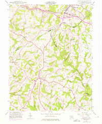
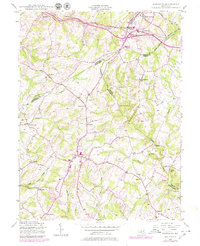
1944 Map of Damascus
USGS Topo · Published 1975About this map
Damascus serves as a central hub on this mid-century survey, situated at the intersection of several critical ridges where Montgomery, Howard, Carroll, and Frederick counties converge. The geography is defined by the headwaters of major drainage systems, including the Patuxent River, South Branch Patapsco River, and Great Seneca Creek, which originate in the high ground near Parrs Spring. The northeastern corner is anchored by the rail corridor of the Baltimore and Ohio, where the town of Mount Airy sits along the county line.
Find a feature on this map
34 named features on this map. Tap any name to fly to it.
Don’t see what you’re looking for? This feature index may not catch every label — zoom into the map to look around manually.
Map Details
Editions of this 1944 Damascus Map
5 editions found
Other maps of this area

1893 · Frederick
USGS Topo · 1:125,000

1894 · Frederick
USGS Topo · 1:125,000

1908 · Rockville
USGS Topo · 1:62,500

1908 · Seneca
USGS Topo · 1:62,500

1908 · Ijamsville
USGS Topo · 1:62,500

1909 · Mount Airy
USGS Topo · 1:62,500

1909 · Ijamsville
USGS Topo · 1:62,500

1923 · Rockville
USGS Topo · 1:62,500

1942 · Frederick
USGS Topo · 1:62,500

1944 · Walkersville
USGS Topo · 1:31,680